
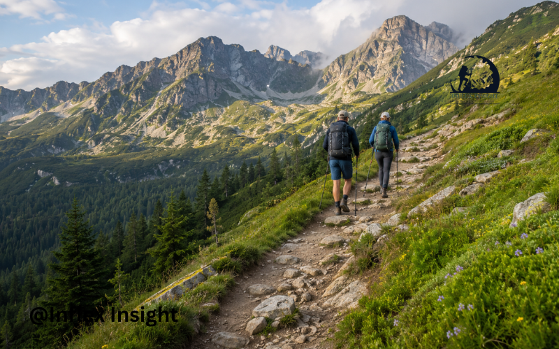
Hiking the Carpathians offers a quieter and wilder alternative to Europe’s busiest mountain destinations. The Carpathian Mountains form a wide arc through Central and Eastern Europe, crossing the Czech Republic, Slovakia, Poland, Hungary, Ukraine, Romania, and Serbia.
The region includes sharp peaks, deep forests, alpine meadows, clear lakes, limestone caves, and traditional mountain villages. Hikers may also enter habitats used by brown bears, wolves, lynx, chamois, and many bird species. The Carpathians contain some of Europe’s most important forests and large-carnivore populations, making responsible travel especially important. UN Environment describes the range as the second largest mountain system in Europe.
There are options for almost everyone, from families seeking easy valley walks to experienced hikers planning remote ridge routes. However, transport, trail markings, accommodation, and park rules differ across countries. This guide explains where to hike, when to visit, what to carry, how much to budget, and how to stay safe.
Understanding the Carpathian Mountain Range
The Carpathians are usually divided into Western, Eastern, and Southern sections. The Western Carpathians include the Tatras in Slovakia and Poland. These mountains contain high rocky peaks, developed trail networks, and many mountain huts.
The Eastern Carpathians extend through parts of Poland, Slovakia, Ukraine, and Romania. They often feel more remote, with long forested ridges, open grasslands, and scattered villages. The Southern Carpathians are mainly in Romania and include rugged areas such as Făgăraș, Retezat, Bucegi, and Parâng.
Conditions change greatly with elevation. A warm village may sit below a cold, windy ridge where snow remains. Some paths are smooth forest tracks, while others cross rock, loose scree, mud, or exposed ground. The mountains are also home to communities with long traditions of farming, shepherding, woodcraft, and seasonal movement.
Best Countries for Hiking the Carpathians
Slovakia
Slovakia is one of the easiest places to begin a Carpathian hiking trip. The High Tatras offer dramatic peaks, mountain lakes, waterfalls, and a strong network of marked paths. Many routes connect with staffed huts where hikers can rest, eat, or stay overnight.
The Low Tatras have longer forest and ridge walks, including sections suitable for multi-day trekking. Although navigation is generally straightforward, selected high trails close during the winter season. Always review current warnings and closures on the official Tatra National Park website before leaving.
Romania
Romania provides some of the most varied and remote hiking in the Carpathians. The Făgăraș Mountains are known for demanding ridge journeys, while Bucegi offers plateau walks and easier access from popular towns. Retezat is famous for glacial lakes, and the Apuseni Mountains combine gentle hills, caves, forests, and villages.
Romanian routes may involve longer distances between services. Trail markings can fade in isolated areas, so an offline map is important. In Retezat National Park, visitors must follow marked trails and use designated camping areas. Open fires are restricted, and hikers must carry out their rubbish under the park’s official visitor rules.
Poland
Poland offers both popular mountain routes and quieter countryside. Zakopane is the main base for the Polish Tatras, where trails lead to lakes, valleys, passes, and difficult summits. Popular paths can become crowded during summer weekends and public holidays.
For a calmer experience, consider the Bieszczady Mountains in southeastern Poland. Their broad grass-covered ridges provide wide views without the same technical difficulty as the highest Tatra routes. Rules, entrance requirements, trail conditions, and closures should be checked through the official Tatra National Park portal.
Ukraine
The Ukrainian Carpathians include the Chornohora range, home to Hoverla, the country’s highest mountain. The area is known for rolling ridges, forests, wooden villages, and Hutsul culture.
However, leisure hiking in Ukraine currently requires serious security consideration. As of August 2026, the UK Foreign Office advises against all but essential travel to western regions that include Zakarpattia and Ivano-Frankivsk. Ukraine’s airspace remains closed, and security conditions may change quickly. Travellers should consult their own government’s latest advice and confirm whether insurance remains valid. See the current Ukraine travel advisory before making plans.
Other Carpathian Regions
The Czech Republic has accessible routes in the Moravian-Silesian Beskids, while Hungary offers lower walks in ranges such as the Mátra and Bükk. Serbia’s Carpathian areas provide forest paths, caves, and quieter peaks.
These smaller regions work well for relaxed day hikes or combined cultural trips. Cross-border trekking is possible in some areas, but hikers must check border rules, transport links, park regulations, and insurance coverage for every country included.
The Best Time to Go Hiking in the Carpathians
For most visitors, the main hiking season runs from June through September. Summer brings longer daylight and better access to high trails, but afternoon storms can develop quickly. July and August are usually the busiest months in the Tatras.
Spring can be beautiful at lower elevations, although mud, swollen streams, and snow may remain higher up. Early autumn often brings clear air, colorful forests, and fewer people. Nights become colder, mountain huts may reduce their services, and daylight hours shorten.
Winter hiking requires different skills and equipment. Snow, ice, avalanche danger, and seasonal closures can turn an ordinary summer path into a serious route. Elevation matters more than the calendar, so check local forecasts and trail reports rather than relying only on conditions in the nearest town.
Choosing the Right Carpathian Hiking Route
Choose a trail according to the least experienced person in your group. Distance alone does not show difficulty. Elevation gain, exposed sections, loose rock, weather, pack weight, and access to water can make a short route exhausting.
Day hikes are easier to organize because you can stay in one town and adjust plans each morning. Multi-day routes offer a deeper experience but require careful planning for huts, campsites, food, water, and transport.
Circular routes simplify transport, while point-to-point hikes may provide more variety. A local guide can be valuable on unmarked terrain, winter routes, exposed ridges, or remote Romanian trails. Guides can also help visitors understand local wildlife and village customs.
Memorable Trails and Hiking Areas
The High Tatras contain routes through valleys such as Mlynická and Mengusovská, along with lake walks and challenging paths toward high passes. Some difficult trails include chains or exposed sections and should not be treated as simple walks.
Romania’s Făgăraș ridge is a major multi-day challenge, with steep climbs and changeable weather. Retezat offers a different experience, combining rocky summits with glacial lakes. The Bucegi Plateau provides broad views and several access points, although fog can make navigation difficult.
Bieszczady is ideal for hikers who prefer open ridges and a slower pace. In the Apuseni Mountains, routes often connect caves, forest paths, small farms, and traditional settlements. Visitors seeking solitude should look beyond famous summits and consider lesser-known valleys with reliable markings.
Hiking Difficulty and Trail Conditions
Beginner-friendly options include signed valley paths, village walks, lake routes, and lower forest trails. Moderate hikes often involve several hours of climbing but avoid highly exposed ground. Advanced routes may include narrow ridges, cables, chains, unstable rock, and limited shelter.
Trail marking systems vary between countries. Even on a marked path, signs can be hidden by vegetation or damaged by weather. River crossings may become unsafe after rain, while forest tracks can turn muddy.
Seasonal closures protect wildlife and reduce accidents during dangerous conditions. Never assume a trail is open simply because it appears on a hiking app. Check the relevant national park or mountain rescue service shortly before the hike.
Mountain Huts, Camping, and Places to Stay
Mountain huts are common in the Tatras and some Romanian ranges, but their facilities differ. A hut may offer meals, drinking water, shared rooms, or only basic emergency shelter. Popular huts should be reserved early during summer.
Village guesthouses are often comfortable and give visitors a chance to support local families. They can also help with meals, transport, and information about current trail conditions.
Wild camping rules are not the same throughout the Carpathians. Some parks allow tents only at designated sites, while others have stricter limits. Confirm the rules for the exact park rather than following general advice found online. Carry a stove only where permitted and never assume an open fire is allowed.
Getting to and Around the Carpathians
Useful gateway cities include Kraków and Zakopane in Poland, Poprad in Slovakia, and Brașov, Sibiu, and Cluj-Napoca in Romania. Trains and buses reach many popular towns, but remote trailheads may require a taxi, local minibus, or rental car.
Public transport can be less frequent on weekends or outside summer. Point-to-point routes require extra care because the final bus may leave early. Ask your accommodation provider about local transport and confirm return options before starting.
Cross-border journeys take longer than they appear on a map. Allow time for changes, delays, and border procedures. Download offline maps because mobile coverage may disappear in valleys and forests.
Essential Gear for Hiking the Carpathians
Strong hiking shoes with good grip are important on mud, wet rock, and steep ground. Carry light layers, a warm top, waterproof clothing, sun protection, and an extra pair of socks. Weather can change even during a short summer hike.
Bring an offline map, charged phone, power bank, headlamp, first-aid kit, emergency blanket, food, and enough water. Water from streams should be filtered or treated when its safety is uncertain. Trekking poles can help on loose slopes and long descents.
Hut-to-hut walkers may need a sleeping liner, while campers require a suitable tent, sleeping bag, stove, and food storage system. Keep the pack light enough to carry safely over the planned terrain.
Wildlife and Mountain Safety
The Carpathians support brown bears, wolves, lynx, wild boar, and other animals. Most wildlife avoids people, but hikers should make normal conversation or other moderate noise in dense vegetation so animals are not surprised.
Never approach, follow, or feed wildlife. Keep food sealed, store it according to local guidance, and do not leave scraps near campsites. If you see a bear, remain calm, do not run, and slowly create distance while following the advice of local park authorities.
Thunderstorms are another major danger, especially on open ridges. Start early, watch the sky, and descend before a storm reaches you. Tell someone your route and expected return time. Solo hikers should be conservative about difficult terrain.
The emergency number 112 works free of charge throughout the European Union, but poor signal can delay contact. The European Commission’s 112 guidance explains how the service operates. Save local mountain rescue contacts as well and consider insurance that specifically covers hiking and rescue costs.
Food, Water, and Resupply Planning
Popular huts may sell soup, simple hot dishes, drinks, and snacks, while small villages often serve filling regional meals. However, opening hours can be seasonal, and card payments are not always available. Carry some local currency and enough food for delays.
Check where reliable water is available before beginning a multi-day route. Do not depend on every spring shown on an old map, especially after dry weather. A filter or purification tablets provide useful backup.
Traditional foods vary by country but often include cheese, potatoes, soups, bread, dumplings, and meat dishes. Dietary needs should be discussed with hut or guesthouse staff in advance.
Costs and Budget Planning
Hiking the Carpathians can be less expensive than visiting the Alps, but costs differ greatly by country and region. Busy resort towns and private rooms cost more than shared hut beds or rural guesthouses.
Your budget should cover accommodation, food, local transport, park fees, equipment, insurance, and emergency flexibility. Guided mountain days increase the total but may be worthwhile for difficult routes.
Prices and entrance systems can change, so check official websites rather than depending on old blog posts. Booking transport and popular accommodation early may reduce costs. Staying in one base and taking day hikes is usually simpler and cheaper than arranging a long point-to-point journey.
Sample Carpathian Hiking Itineraries
A Short Three-Day Mountain Escape
For an easy first visit, base yourself in Poprad or a High Tatras resort in Slovakia. Use the first day for a gentle lake or valley walk, choose a longer marked route on the second day, and keep the third day flexible for poor weather or a shorter hike. Rail connections between Tatra settlements make a car unnecessary for many routes.
A One-Week Carpathian Adventure
A week in Romania could combine two or three days around Brașov and Bucegi with several days in a quieter area. Include a rest or cultural day between demanding hikes. Beginners should use fixed accommodation, while experienced hikers may add a carefully planned overnight route.
A Multi-Country Carpathian Journey
A practical combination is southern Poland and northern Slovakia because the Tatras cross the border and both sides have established tourism services. Allow at least one week, preferably longer. Do not plan a different country every day; transport connections and changing weather can quickly make the schedule unrealistic.
Responsible Hiking in the Carpathians
Stay on approved paths, follow signs, and respect temporary closures. Carry out all rubbish, including food waste, tissues, and hygiene products. Use toilets where available and follow accepted waste practices in remote areas.
Keep noise low, avoid disturbing livestock, and close gates behind you. Never collect protected plants or damage caves, rocks, and trail signs. Choose local guesthouses, guides, restaurants, and transport services when possible. These choices help mountain communities benefit from tourism while protecting the landscapes visitors have come to enjoy.
Common Planning Mistakes to Avoid
A common mistake is choosing a route based only on distance. Always study climbing, descent, terrain, and expected walking time. Another mistake is relying entirely on a phone without downloading maps or carrying backup power.
Do not ignore local forecasts because the morning appears clear. Avoid reaching a busy area without hut or accommodation reservations during peak season. Poor footwear and missing rain protection can turn a pleasant walk into an unsafe experience.
Most importantly, do not assume that camping, fires, dogs, drones, trail access, and park fees follow one Carpathian-wide system. Regulations are local and must be checked for each protected area.
Conclusion
Hiking the Carpathians can mean an easy walk beside a mountain lake, a journey between traditional villages, or a demanding trek across a remote ridge. That variety is one of the region’s greatest strengths.
A rewarding trip begins with a realistic route, suitable gear, flexible timing, and respect for local rules. Check weather reports, closures, transport, accommodation, and official travel advice shortly before departure. With thoughtful planning, hiking the Carpathians offers memorable scenery, rich culture, abundant wildlife, and a quieter view of Europe’s mountain landscapes.
FAQs
1. Are the Carpathians suitable for beginner hikers?
Yes. The region has gentle valley walks, forest paths, village routes, and accessible lake trails. Beginners should choose a well-marked day hike, check elevation gain, start in good weather, and stay near an established base such as Zakopane, Poprad, or Brașov.
2. What is the best month for hiking the Carpathians?
July through September usually provides the best access to high routes, although July and August can be crowded. September often offers cooler weather and fewer visitors. Conditions differ by elevation and country, so current forecasts and seasonal closures must still be checked.
3. Are there bears in the Carpathian Mountains?
Yes. Brown bears live in several Carpathian regions, particularly in Romania and parts of Slovakia, Poland, and Ukraine. Encounters are not guaranteed, but hikers should avoid surprising animals, secure food, keep their distance, and follow local park advice.
4. Can you hike across several Carpathian countries?
Yes, but a multi-country trip requires more planning than a single-region visit. Check border requirements, transport connections, park regulations, insurance, and current security advice. Poland and Slovakia are among the simplest countries to combine because their established hiking areas meet in the Tatras.